


11974352-La Fourche 16.85

togolo28
User
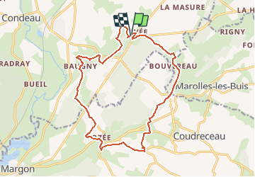

Length
16.9 km

Max alt
229 m

Uphill gradient
317 m
Km-Effort
21 km

Min alt
124 m

Downhill gradient
318 m
Boucle
Yes
Creation date :
2020-09-03 11:04:22.479
Updated on :
2020-09-03 11:04:55.048
4h33
Difficulty : Medium

FREE GPS app for hiking
 SityTrail
IGN / Geographical institutes
SityTrail Plus
The world is yours!
About
Trail Walking of 16.9 km to be discovered at Normandy, Orne, Sablons sur Huisne. This trail is proposed by togolo28.
Positioning
Country:
France
Region :
Normandy
Department/Province :
Orne
Municipality :
Sablons sur Huisne
Location:
Coulonges-les-Sablons
Start:(Dec)
Start:(UTM)
343672 ; 5360541 (31U) N.
Comments